PLANNING

Find true independence with streetcars, not freeways
A rare joy in Charlotte is being able to live a compact, transit-supported lifestyle, where soul-sapping commuter journeys on interstates or arterial highways can be avoided. My wife, Linda, and I have worked hard to craft such a lifestyle, “aging in place” in Dilworth, where almost everything we need is within a mile of our […]
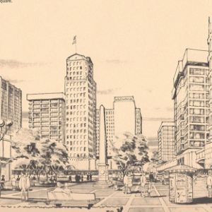
Mid-20th-century plans for central Charlotte
Sketches below aer are from the 1966 Greater Charlotte Central Area Plan by A.G. Odell Jr. and Associates. Map is from the 1960 Wilbur Smith Master Highway Transportation Plan.

Much to admire in plan, but it missed an opportunity
Just for fun, before watching Monday night’s Charlotte City Council hearing on the newest plan for downtown Charlotte, I hauled out my yellowing copy of the 1966 Odell Plan. (See original drawings from the plan here.) It’s both fun and humbling to see how stunningly wrong that plan was about so much. Then I thumbed […]
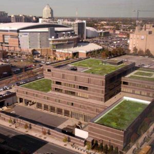
Failure of nerve: Bolder vision needed for an uncertain future
Charlotte’s draft 2020 Vision Plan is a disappointing document. Despite the hard work, the glossy graphics are mostly pretty pictures of conventional thinking rather than visions for a different future. A plan promoted as visionary should acknowledge that urgent environmental and economic forces demand challenging changes to the status quo, and then propose far-reaching and […]

Historic Salisbury
The City of Salisbury has had great success as a community in preserving its past. These photos highlight some examples of the many treasures in its commercial center and historic neighborhoods. Read related article on this site. Photographs by Nancy Pierce

Smart Growth and the 2010 Census
The following commentary first appeared in the April 29, 2011 issue of the Charlotte Business Journal: Initial population data from the 2010 Census show that the Charlotte region maintained its status as one of the nation’s fastest growing metro areas. Charlotte grew to a population of 731,424 in 2010, an increase of 35.24% since 2000. […]
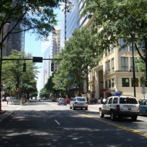
Should Charlotte Look Like Paris or Atlanta?
What should Charlotte look like? When discussing urban design many planners, architects and developers assume that what works in New York, San Francisco and Portland should work here. This assumption ignores the reality that Southerners have a very different perspective on “urbanness” than non-Southerners. No one has asked Charlotteans what they want their city to […]

New Partners for Smart Growth Conference – A Review
Despite early February blizzards across the northern U.S. that cancelled flights and upended travel plans, over 1,300 people came to Charlotte last week for the 10th annual New Partners for Smart Growth Conference. About 1,000 of them came from outside the Carolinas, including a dozen or so from outside the U.S. They flocked to the […]

Persistently Green: Landscapes in Transition
It’s no secret that the Charlotte region has been rapidly growing more urban over the past few decades. Yet despite the record expansion of the urbanized area experienced during economic boom times, private landowners cling to over two million acres of undeveloped land in the Charlotte metropolitan region. Why do these remnants of green persist? […]
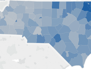
Mapping historical development patterns and forecasting urban growth in Western North Carolina
The Renaissance Computing Institute (RENCI) at UNC Charlotte expanded the urban growth mapping and forecasting into 19 counties in the Western part of North Carolina: Alleghany, Ashe, Avery, Buncombe, Cherokee, Clay, Graham, Haywood, Henderson, Jackson, Macon, Madison, Mitchell, Polk, Swain, Transylvania, Watauga, Wilkes, and Yancey Counties. The final report maps historical development patterns from 1976-2030 […]