A Trip to the W.T. Alexander Plantation Cemetery for Enslaved Persons

By Maris Bey, MSW Intern
As a part of my internship with the UNC Charlotte Urban Institute, I completed a project on the history of race, racism, and resistance at UNC Charlotte. A significant component of this work focused on the land of UNC Charlotte’s campuses. Through this research, I learned that a portion of the main campus is composed of land that was previously the W.T. Alexander plantation. W.T. Alexander owned and operated a cotton plantation that reached 935 acres at its height and enslaved at least 30 individuals. His daughter-in-law, Mary Charlotte Walker Alexander, inherited this land. In 1957, she donated five acres of this former plantation to Charlotte College for a road leading to the new campus.
 During this research, I found information from Charlotte Mecklenburg Library, the Charlotte-Mecklenburg Historic Landmarks Commission and local historian Dr. Dan L. Morrill about the cemetery where the enslaved individuals on the plantation were buried. However, the details about the location and accessibility were outdated and inconclusive.
A team of Charlotte Urban Institute staff decided to find the site.
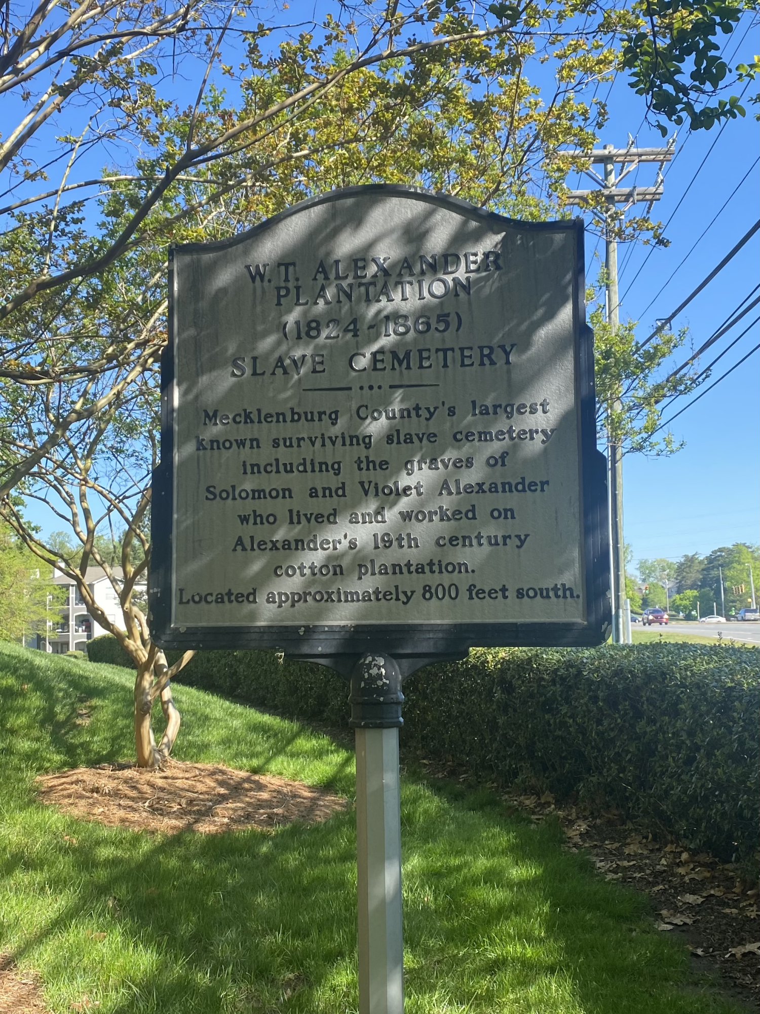
We knew there was a historical marker at the entrance to the Thornberry Apartments on Mallard Creek Church Road, so this was our starting point. The historical marker reads:
“WT Alexander Plantation (1824-1865) Slave Cemetery. Mecklenburg County’s largest known surviving slave cemetery including the graves of Solomon and Violet Alexander, who lived and worked on Alexander’s 19th-century cotton plantation. Located approximately 800 feet south.”
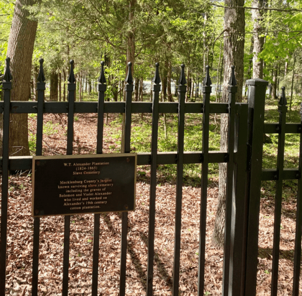
With the directions of “approximately 800 feet south” and directions from the Charlotte Mecklenburg Library that the cemetery is to the “left and back of the property,” we set off. After several wrong turns, we spotted a wrought iron fence around a section of woods next to the apartment complex’s tennis courts. A sign on the locked entrance confirmed we had found the cemetery. We walked along the outside of the fence and could see a collection of rocks that seemed to be intentionally placed as headstones. We walked back to the leasing office and asked if there was a key to unlock the gate. Using a driver’s license as collateral, we borrowed the key and returned to the cemetery.
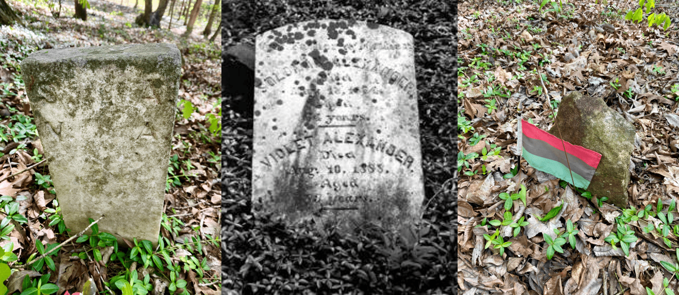
Once inside, we could see at least 30 graves marked with rocks at the head and foot. One stone was engraved with the letters “S.A. V.A.,” which we determined was possibly the marker for Solomon and Violet Alexander. A photo from the Charlotte-Mecklenburg Historic Landmark Commission (middle image) shows a more detailed engraved headstone, which we did not find. At some point in the last few years, the graves had been tended and some were garlanded with Pan-African flags and artificial flowers. And though there were a few pieces of trash and lost tennis balls we picked up, the wooded area was largely unblemished by the world outside its gates.

Standing in a cemetery elicits reflection on our impact on the world and the systems in which we live. Even in death, race and racism were reflected. Standing in the final resting place of individuals whose names and stories are unknown to us was very humbling. It was easy to learn so much about W.T. Alexander: his history, family, and impact on the community. UNC Charlotte’s Atkins Library houses a collection of some of the family’s records. And though there may be oral and family traditions of the individuals we visited, I found no accessible record of their existence beyond an unengraved stone.
The purpose of visiting the cemetery was to acknowledge and understand the history of where UNC Charlotte is located. This work reminds us that we all live, work, and learn within the context of a history that may have benefited or hindered us. When you drive on Mary Alexander Road onto campus, I invite you to remember that this place has a history beyond what is visible today.
Directions to the cemetery:
Note: Be mindful that the cemetery is within a private residential apartment community. If you choose to visit, please be respectful of the residents and management. Also, please respect the cemetery, especially if you go inside the fence.
- Enter Thornberry Apartment Complex (9920 Brickleberry Ln, Charlotte, NC)
- Check-in with the leasing office at the front entrance. (Monday-Friday, 9 am to 6 pm, Saturday, 10 am to 5 pm).
- Walk or drive from the leasing office to the cemetery. The cemetery is next to the apartment’s tennis courts, and the entrance is located on Woodberry Trail Lane.
- Look for a wooded area surrounded by a wrought iron fence.
- GPS Coordinates: 35.323227, -80.738450