Creating a Charlotte Region Zoning Atlas
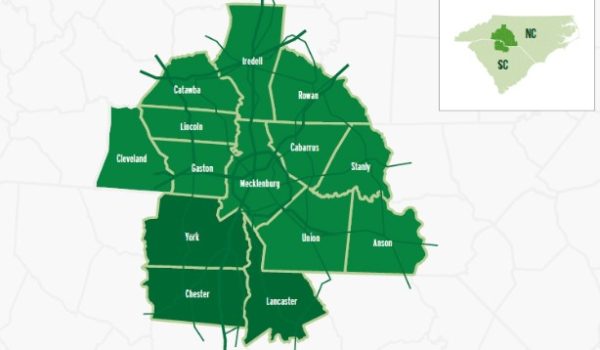
The UNC Charlotte Urban Institute, with generous funding from the Mercatus Center of George Mason University, is participating in a national research project designed to collect data about zoning laws from around the country. The Charlotte Region Zoning Atlas will collect information about zoning ordinances that have been adopted across the 14-county region served by the Charlotte Urban Institute.
Zoning is one of the most important policies adopted by local governments. It is the dominant type of land use regulation in the U.S. (though not in other developed countries). It works by limiting the type and intensity of use landowners may make of their property. That is, just because you own your property, you cannot build whatever you want on it, even if you have the financing and customer base to support your plans. You also need legal permission from the local zoning authority.
Zoning is Controversial
Despite its ubiquity, zoning is controversial. Critics of zoning offer several distinct lines of attack:
- Zoning has its roots in exclusion. It was adopted by towns to establish and perpetuate residential segregation by race and economic status.
- Zoning locks in land-use patterns despite changing contexts, frustrating the economic dynamism that leads to greater productivity and prosperity in communities.
- Zoning mandates building and neighborhood typologies that prioritize automobile-centric living, with negative consequences for mobility, accessibility, public health, and environmental sustainability.
- Zoning interferes with the rights of property owners to do what they want with their land.
Such criticisms (and others) were expressed recently in Charlotte during conversations about the city’s 2040 Future Comprehensive Plan and the Unified Development Ordinance, which will constitute Charlotte’s zoning ordinance when it goes into effect this summer. Zoning is critically connected to many important topics we regularly care about at the local level: affordable housing, transportation, economic development and opportunity, and even education.
Although there’s widespread agreement about the importance of zoning, scholars face challenges in studying its consequences because of the way zoning laws are established.
Zoning is Local Policy
Here’s a quick primer. Zoning authority is granted to local governments by state governments. These local zoning authorities—think a city council—then adopt two legal documents:
- a zoning ordinance, defining a set of zoning district types; and
- a zoning map, identifying which type of zoning district applies to each parcel of land within the municipality’s jurisdiction.
That means zoning is a local policy. Every municipality can create its own bespoke zoning districts. And even if two municipalities have zoning classifications that function in exactly the same way, they may label those zoning districts in different ways. One town may call the zoning designation that allows drive-through fast-food restaurants “B-2” (“B” for “business”) while another might use the label “Commercial District.”
Charlotte’s zoning ordinance is totally different from Kannapolis’s zoning ordinance, which is totally different from Shelby’s zoning ordinance.
The hyper-locality of zoning makes it difficult to conduct careful, cross-jurisdictional analyses. Think of it: how can a scholar assess the effects of a particular type of zoning if every city uses different zoning classifications? This situation frustrates research and learning. We can’t learn from others; others can’t learn from us. It prevents identification of broad patterns and opportunities to discover generalizable solutions. Even within a single metropolitan area, variation in zoning from town to town prevents the development of regional knowledge. In a sense, every municipality has developed its own language to regulate land use.
An Emerging National Tool
That’s where zoning atlases come into play. The National Zoning Atlas is an initiative to standardize the classification zoning ordinances across the U.S. for research purposes. It is an effort to create a common language for talking about land use regulations anywhere and everywhere.
To be clear, this is an effort to create a database of zoning districts using common naming conventions to enable efficient analysis by researchers. The National Zoning Atlas is not an attempt to change the official names of these zoning classifications or to impose a standard land use regulation approach everywhere. The National Zoning Atlas will be a tool to help us better understand how zoning works by facilitating analysis across a wider range of contexts.
The National Zoning Atlas is the brainchild of Sara Bronin, professor and director of the Legal Constructs Lab at the College of Architecture, Art, and Planning at Cornell (and associated faculty member at Cornell Law School). According to Bronin, “The National Zoning Atlas is addressing an essential need for more and better data to understand the consequences of zoning on the lives of people in the U.S.”
The ultimate result of the National Zoning Atlas project will be an interactive map where users can explore the types of zoning used in various municipalities across the country. Users will be able to see, for instance, where cities permit multifamily housing. Behind the scenes, the National Zoning Atlas’s database will geo-code the location of various types of zoning classifications. This will be an invaluable data source for researchers seeking to understand the connections between zoning and other important phenomena.
“The National Zoning Atlas will illuminate the scope and impact of land use regulation nationally,” notes Bronin. “It will also unlock secondary research on zoning’s effects on economic productivity, the environment, housing affordability, and even equity. Once we’re able to see how zoning works, we’ll be able to make better choices about changing them for the better.”
To date the National Zoning Atlas project has attracted teams from across the country. There are efforts to create zoning atlases in eighteen states, including major population centers like California, New York, and Texas and smaller states like Montana, New Hampshire, and Rhode Island. State-level zoning atlases have already been completed for Connecticut and Montana.
The Charlotte Region Zoning Atlas
The Charlotte Region Zoning Atlas will be the Charlotte Urban Institute’s contribution to the National Zoning Atlas. The Atlas will use the National Zoning Atlas’s standardized coding scheme to classify how the Charlotte region’s municipalities have chosen to regulate the land within their borders.
The Charlotte Region Zoning Atlas will help us understand how zoning affects patterns of development across the Charlotte region. Researchers will be able to make use of the data to evaluate how different zoning classifications are connected to important outcomes related to opportunity, efficiency, prosperity, equity, and sustainability.
The project will be an important contribution to the University’s significant and ongoing community-engaged scholarship. “The Charlotte Region Zoning Atlas complements our efforts to serve the Charlotte region,” notes Dr. Lori Thomas, executive director of the Charlotte Urban Institute and the Charlotte Regional Data Trust. “Like the Quality of Life Explorer and the Charlotte Regional Data Trust, this will be available for the community and the university. The Zoning Atlas data will be a powerful tool to combine with our other data resources, research, and policy analysis to help us identify ways we can ensure that the Charlotte region’s prosperity is shared by all its residents.”
Next Steps
The first stage of the Charlotte Region Zoning Atlas project involves the collection of all current zoning ordinances and maps from the region’s municipalities (any members of local planning staff who want to make our job easier by sending those files directly to me should feel free to do so!). Our team includes Dr. Eric Moore, a research associate at the Charlotte Urban Institute; Mimosa Khatun, a public policy doctoral student; and Annabelle Hill, an undergraduate Levine Scholar at UNC Charlotte.
Next, our team will carefully read the zoning ordinances themselves and categorize the various zoning districts according to the National Zoning Atlas’s standard coding scheme. Finally, we will link these zoning classifications to the zoning maps in order to create an interactive map displaying how different zoning-category types are distributed across the region.
Again, this is not an attempt to change any policies. Rather, the Charlotte Region Zoning Atlas will simply allow researchers to conduct research across jurisdictional lines by classifying zoning designations according to a standardized nomenclature. Right now we can’t compare apples to apples (or even apples to oranges) because—essentially—each town uses a different name for the same type of fruit. In creating the Charlotte Region Zoning Atlas, the Charlotte Urban Institute will simply go through a process of sorting zoning classifications across all jurisdictions in the region and giving the same name to those classifications that operate the same way.
The project’s findings and accompanying analyses should help policymakers and community stakeholders. Scholarly research into the consequences of zoning is playing an important role in informing conversations about land use reform.
The point of policy is to produce outcomes more consistent with our societal values. The Charlotte Region Zoning Atlas will help the region identify the ways in which our current land use policies might be falling short of this objective. And it should help our region’s communities create more effective policies going forward.