Geographer Stuart helped put ‘region’ in Charlotte regionalism

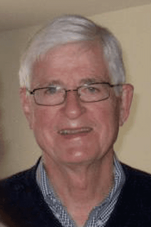
Those of us who knew Al Stuart are saddened by his passing on Nov. 1. Dr. Alfred Stuart, professor emeritus of geography and earth sciences, had a long and distinguished career at UNC Charlotte. I had the good fortune to work with him for more than 40 years, and I believe we should take a minute to appreciate and celebrate his accomplishments, many of which continue to have an impact on our region and state.
Although he did not invent the idea of regionalism, he was part of an effort, with his close colleagues, Jim Clay and Doug Orr, to begin talking about the Charlotte region as we know it today.
Clay and Orr authored the Metrolina Atlas (1972), identifying the larger region around Charlotte as “Metrolina.” Some say the term was coined in Cabarrus County, as it made an effort to be identified as part of the Charlotte region. Others claim it came from a discussion led by the Brookings Institute, which the university had hired to assist the newly formed Institute for Urban Studies and Community Service (now the UNC Charlotte Urban Institute) in developing a plan to serve the region.
Regardless of its origin, the atlas was one of the first public uses of the term to describe a region larger than the census definition of the SMSA (Standard Metropolitan Statistical Area), which was, at the time, the typical way of defining urban regions. As an economic geographer, Al was keenly interested in the forces of the marketplace and viewed them as regional in scope. Throughout his career he espoused looking regionally at issues that confront us.
Al Stuart and his colleagues were responsible for publishing a number of atlases. The innovation most identified with this group was to present an atlas as more than just a series of pictures, graphs and maps. Their atlases had all that, but also had narratives based upon the data, maps and graphs. These were serious books that were revolutionary not only in the display of information but path-breaking in how this information was used in narratives on the important issues of the day.
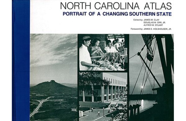
In 1975, these three people—Al Stuart, Jim Clay and Doug Orr—authored the North Carolina Atlas: Portrait of a Changing Southern State. This atlas, with a forward by Gov. Jim Holshouser, became the go-to source for anyone looking to describe how North Carolina had changed and was changing. In a sense, this became Al’s life-long work. He retired in 1999, and a major update was published in 2000. And through most of his retirement, Al continually provided atlas users with updates, as information changed and new analyses occurred.
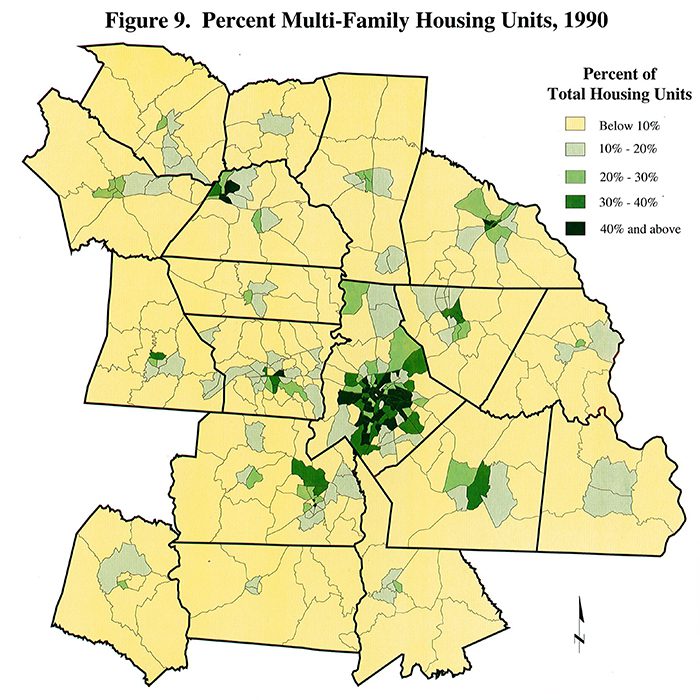
Even today, anyone looking at this series of atlases would be amazed by the graphics—or in today’s terms, data visualization—found in these books. You would be even more amazed if you knew how they were produced. Back in the day, before we had computer-generated graphics at our finger tips, the graphic content was produced in the biggest cut and paste operation one can imagine. It was called cartography, and the cutting and pasting were literal, with scissors, colored pieces of paper and plastic, and glue. (See illustration below, from 1994.)
The UNC Charlotte Geography Department had one of the best, if not the best, cartography programs in the United States, and one of its primary tasks was to produce the graphics for the atlases. Al was instrumental is putting the lab together, and Jeff Simpson, head of the operation, was accorded almost co-author status by the three people doing these atlases because of his ability to have his team achieve at the highest level. While the old cartography program has been replaced by new technology, the department continues to excel in GIS training and data visualization.

Al Stuart served a lengthy term as chair of the Department of Geography and Earth Sciences and was instrumental in building one of the strongest departments on campus. The defining feature of this strong department was—and is—its emphasis on applied research and the accessibility of that research to the localities in this region.
This university was begun on the notion that it would be an urban university that would directly connect with the larger community in studying and discussing the issues that define us. Al Stuart took that declaration of purpose to heart, and he built a department that continues to carry out that mission.
Dr. Al Stuart’s positive impact on this campus, Charlotte, the region, and the state is the powerful legacy he leaves with us.
Bill McCoy is retired director of the UNC Charlotte Urban Institute, professor emeritus of political science, and former associate vice chancellor for extended academic programs.