Ever wondered … are there secret creeks in uptown Charlotte?

Mecklenburg’s 3,000 miles of creeks run through every part of the county. This includes uptown Charlotte, although such an urbanized spot of land might be the last place you would expect to find creeks.
Many of uptown’s small creeks have been hidden from view over the years as land uses changed and storm pipes and drains were built. But if you’re reading this article uptown, you might be on top of a creek right now.
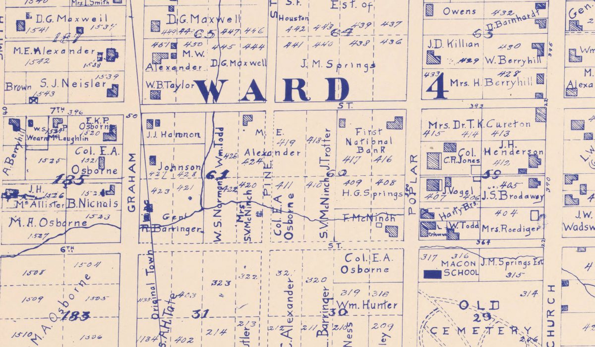
See larger imageFor a large, high-resolution version of the 1877 map, see below or click here for a link to it at the UNC Chapel Hill library. |
Uptown Charlotte sits atop a small rise between Irwin and Little Sugar creeks, and rainwater has to drain somewhere. With so many buildings and streets, uptown has a large amount of impervious surface – the pavement and rooftops where water can’t easily soak into the ground. Instead, rain flows into gutters and storm drains. In Charlotte, those storm drains are piped straight into the creeks.
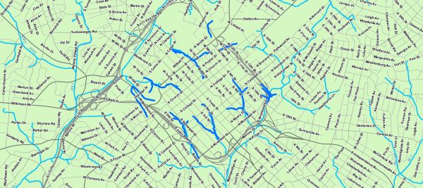
In uptown, the small creeks that flow down from the ridge are now underground. That was not always the case, however. An 1877 Charlotte map, created by Frederick Beers and Co., shows how both the city and the creeks that run through it have changed. The map shows Charlotte as it was, a small town no bigger than the area that today is within the uptown interstate highway loop of I-77 and I-277. Some of the creeks depicted on the 1877 map don’t show up on today’s maps. The creeks that once flowed openly beside the city streets now lie under them.
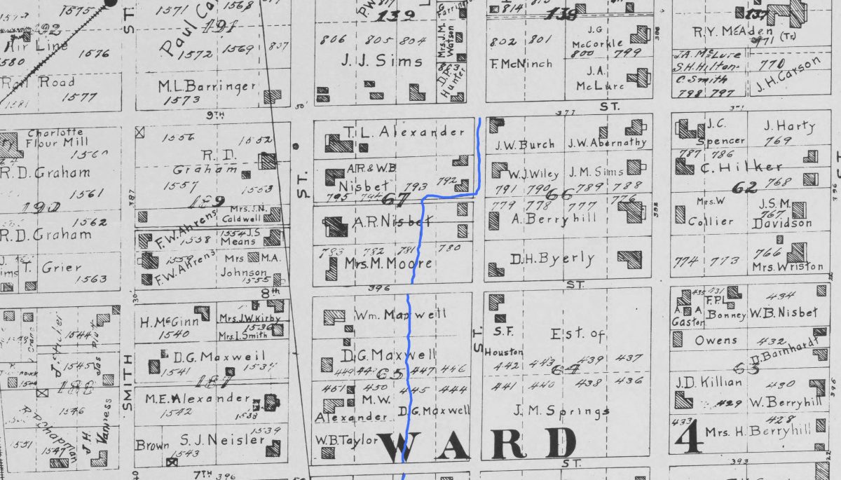
By taking the old map and overlaying it on a modern one, we can see some of the changes in the landscape since 1877.
Many creeks have not changed course since 1877 and follow roughly the same path today. The difference is that some are now underground, in pipes. They were hidden to make way for development.
Today, our modern storm water control infrastructure has all but hidden these creeks from our everyday experiences.
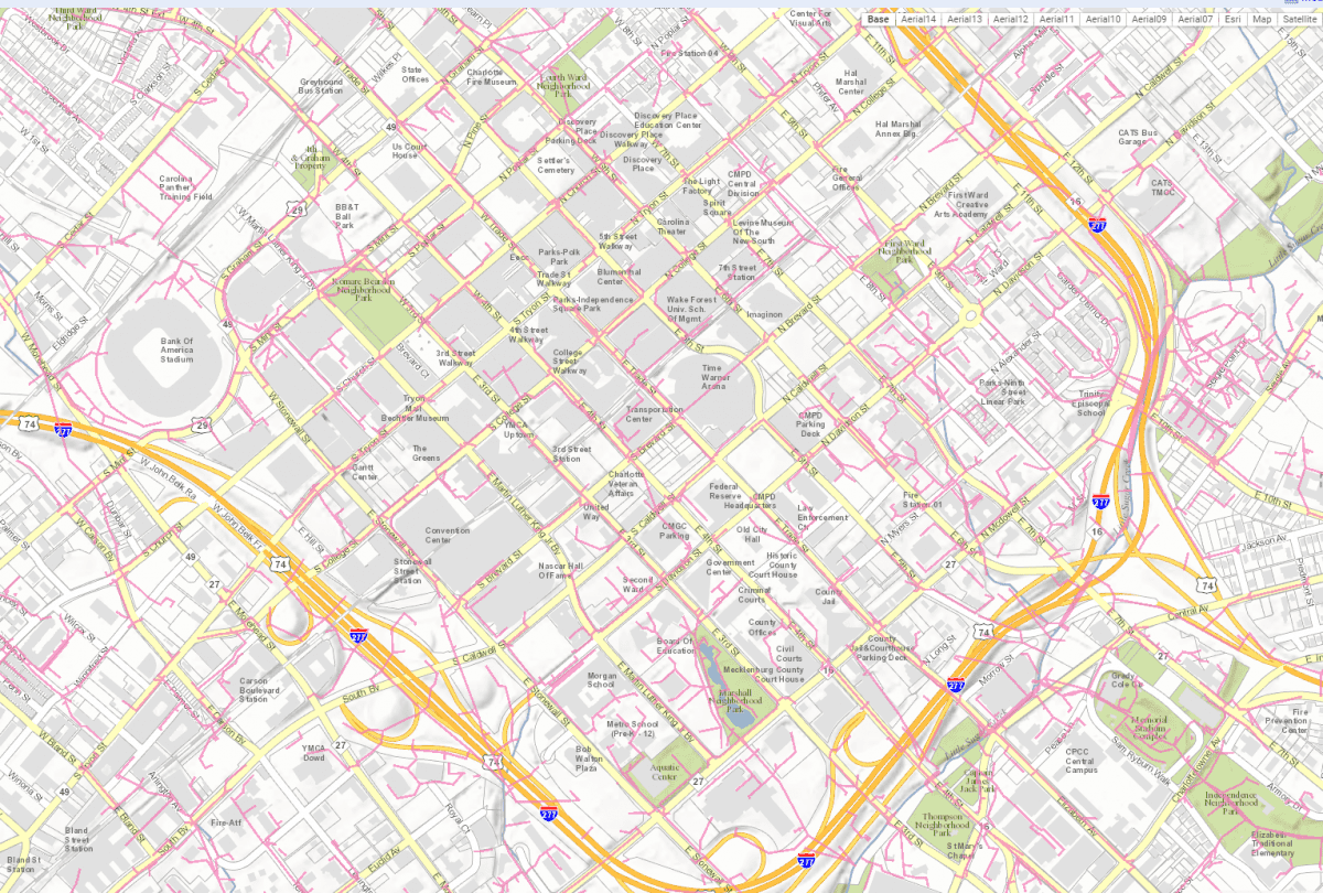
For example, according to Daryl Hammock of the City of Charlotte’s Storm Water Services Division, a large pipe system (see image below) carries a small tributary of Little Sugar Creek past the Charlotte-Mecklenburg Government Center on Fourth Street, through Marshall Park, and out into the main channel of Little Sugar Creek.
Like all bodies of water, creeks and rivers change their course as they change the land around them. Humans further alter the environment. Even the 1877 map shows evidence of streams re-routed around property lines. (Scroll below to see one example.)
In 1877, the uptown creeks started closer to the center of uptown at the intersection of Trade and Tryon than they do now. They flowed in and around streets, across yards and building parcels and doubtless made it more difficult to travel around the city, as well as to build.
The 1877 map shows a creek that started near Church Street flowing right through the spot where the Panthers now play, at Bank of America Stadium. Now that creek is piped and flows under and around the stadium.
Not all creeks stay hidden forever. The parking lot for Charlottetown Mall, built in 1959, covered a section of Little Sugar Creek, and over time nearby development covered more of it. With the creation of the Metropolitan mixed use development and Little Sugar Creek Greenway in 2010, the cap finally came off the creek. (Learn more about the history of Little Sugar Creek at: “Little Sugar: The creek the city loved to hate.”)
It’s unlikely any of the creeks uptown will once again see the light of day, but it’s worth remembering the creeks that lie beneath our feet.

