Moving from zoning’s alphabet soup to describing real places

[highlightrule]You probably know places you like. And you probably don’t know whether they’re MUDD-O, R-22MF or UR-2(CD). A new approach to zoning lets us envision places we like and then come up with ordinances that allow us to build them—without the arcane sets of letters and formulas.[/highlightrule]
If I described a well-known locale in Charlotte to you as: MUDD, MUDD(CD), MUDD(O), TOD-M, TOD-MO, NS, I-1, I-2, B-1and B-2, would you have any idea what it looked like? Or felt like?
How about: R-22MF, R-8, O-2, B-1, MUDD-O, UR-2(CD), O-1(CD), and R-3?
Is it clear what these indigestible servings of alphabet soup zoning codes mean? Of course not. They’re arcane collections of abstract formulas that only specialists can translate.
[highlight] For the first part of this two-part essay series, see “How zoning shapes your daily life, even if you don’t know it.” [/highlight]
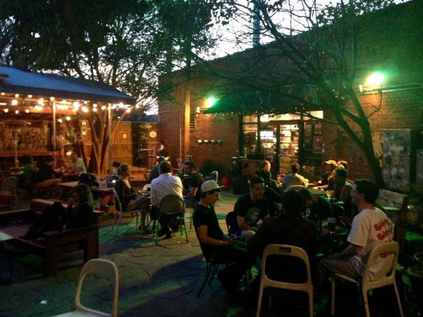
For the first example, try saying: “mixed-use neighborhood.” That’s a simple, straightforward phrase that clearly describes the four- or five-block area around the confluence of Camden Road, Summit Avenue, South Tryon Street and the light rail line in South End (think Phat Burrito, Common Market and Wooden Robot brewery). In that vicinity are shops, offices, restaurants, bars and breweries, music venues, a train station, houses, town homes, apartments, art galleries, even a few remaining artists’ studios, all lining a connected network of streets.
“Mixed-use neighborhood” describes a specific kind of place. You can picture it. You can imagine what that kind of place might look like—the buildings and the spaces between them—and what goes on there. It’s a particular type of place. That’s what, in planning parlance, is called a “place type,” and the desire for this kind of clarity and common sense underpins Charlotte’s push to overhaul its cumbersome and unhelpful zoning code. That long-overdue initiative is underway and projected to last at least into 2018.

This effort builds on the recent progressive practice in towns and cities across America, where place types, and more inclusive definitions of “community character” are replacing old-fashioned, use-based zoning categories.
“Place Types” become the basic building blocks of urbanism. They describe different kinds of built or natural environments, cross-referenced with a menu of compatible uses, images, and specifics of sizes, areas, and densities. Together those simplified sets of information can take the place of old-fashioned zoning rules that deal primarily with uses and ensure parking places for cars but not necessarily good places for humans.
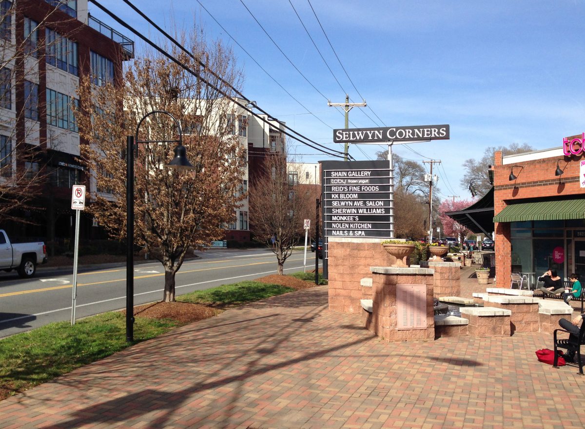
Those outdated zoning terms and their complicated legalistic wording are illustrated by my second serving of alphabet soup, which “describes” a short stretch of Selwyn Avenue in the Myers Park neighborhood between Hillside Avenue and Runnymede Lane. (Think Reid’s grocery and wine bar, Nolen Kitchen restaurant and Mellow Mushroom pizza parlor). Instead of this indigestible mélange of letters and numbers— How about: R-22MF, R-8, O-2, B-1, MUDD-O, UR-2(CD), O-1(CD), and R-3—a zoning ordinance based on place types would say: “mixed-use center” to describe the same area.
[highlight] If we can describe our visions and intentions for the future in plain English, we are more likely as a community to find agreement about how to improve our city.[/highlight]
A “center” is a smaller, more focused area than a “neighborhood,” but this small area still has a wide array of different uses, some within the same building: shops, bars, restaurants, offices, a gym, apartments, single-family homes, town homes, condominiums and a gas station-convenience store. A “mixed-use center” is a simple physical concept of a fairly small but tight area. You could easily describe that kind of place to an out-of-town friend.
Why shouldn’t zoning be that clear?
If we can describe our visions and intentions for the future in plain English, we are more likely as a community to find agreement about how to improve our city.
To illustrate this quest for clarity, some typical place types might be:
- Transit-oriented development (parts of South End)
- Mixed-use neighborhood (Elizabeth)
- Mixed residential neighborhood (St. Albans in Davidson)
- Suburban commercial center (Quail Corners in south Charlotte)
- Single-family neighborhood (take your pick)
- Rural living (harder to find in Mecklenburg County, but perhaps off Grey Road in Davidson)
- Preserved open space (county parks, Little Sugar Creek Greenway, historic sites like Latta Plantation in north Mecklenburg).
(That is just a partial list of my own invention. It is not an official city list.)
But I’m not making up those simple sounding categories on the fly. They already exist in current practice. As long ago as 1995, Davidson Town Planner Tim Keane and I created a new land plan and development code for Davidson, using five rudimentary place types:
- Village center
- Campus
- Village infill
- Rural neighborhoods
- Lakeshore
Today things are more sophisticated, and place types have been refined through extensive work carried out right here in Charlotte.
|
CONNECT our Future
|
Together with other urban design and planning professionals (notably Matt Noonkester, president of City Explained, a private consultancy firm; Jose Gamez of the UNC Charlotte School of Architecture; and Michelle Nance of the Centralina Council of Governments), and with the help of graduate students from UNC Charlotte’s Master of Urban Design program, I was part of a task force investigating future scenarios for the fast-growing Charlotte region. All that work, and a lot more besides, was funded in 2011 by a $4.9 million federal Housing and Urban Development grant for sustainable regional planning for our 14-county region straddling the North Carolina/South Carolina state line.
Our group worked under contract for the Centralina Council of Governments in North Carolina and the Catawba Regional Council of Governments in South Carolina. Together we developed a whole repertoire of place types for use in that multiyear planning effort.
The UNC Charlotte urban design research unit, by mapping conditions in the region, ranging from rural to suburban to urban, identified and collated 31 place types. (Charlotte’s list of place types would be smaller.)
The CONNECT project used this work to support a collaborative visioning process and created a toolkit of policies and practices that can point Carolina communities on a path to greater sustainability. Here in Charlotte, place types have a different role to play.
A new zoning approach based on place types lets us use them as a planning tool to help us envision what we want a community’s character to be in the future.

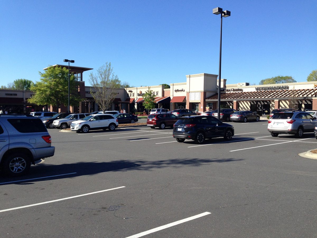
Place types are at the core of urban planning and design. They deal straightforwardly with physical realities and projected futures. As you can see from my partial list of possible place types, they are based on places that exist in the city or surrounding area. Some are better suited to meet future challenges. Others are not. The Quail Corners center, for example, works only for cars and is outdated. As retail trends change, large, single-use shopping centers are likely to become less attractive and profitable. So when such suburban developments become ripe for redevelopment, zoning tools based on place types can provide appropriate regulations for new development patterns more likely to endure for more than a few decades.
This redevelopment process means (re)building pieces of our city in ways that follow these six principles:
- Use less energy for transportation.
- Promote better public health through pleasant and safe options for cycling and walking as alternatives to driving.
- Provide a mix of uses so that we find attractive and useful destinations for our walks.
- Provide a range of economic options for different sectors of society in terms of accessible jobs and housing.
- Preserve and connect the “green” infrastructure of parks, greenways, ball fields and playgrounds so all residents are within an easy walk to a piece of the natural world.
- Create connected pockets of enough density to economically support a variety of public transit alternatives.
That’s a lengthy list, but the leading edge of the private development market is already moving in that direction. Zoning needs to keep up. As Ely Portillo wrote in “Developers look to urban areas, not suburbs, for growth,” in the Charlotte Observer:
“Expect fewer new traditional suburbs and strip malls. Instead, look for more new developments like Waverly on Providence Road, where Childress Klein and Crosland Southeast are building apartments, a Whole Foods, offices, shops and a hotel on a 90-acre site.”
Waverly isn’t perfect—it’s weak on transit options, for example, and has huge parking lots instead of coherent public spaces—but it’s a modest start. It would include “mixed-use neighborhood” and “mixed-use center” place types as zoning categories, but it’s important to realize those designations mean more than a collection of different stuff near to each other. A neighborhood and a “center” imply distinct collective identities and a set of connected public spaces that are used equally and shared between residents and visitors. For example, parts of South End, Dilworth, Plaza Midwood, and NoDa meet these criteria. Most of our existing and proposed suburban commercial developments do not, and applying zoning based on place types to projects like Waverly would drastically improve them.

Authentic neighborhoods are created from public spaces that people share informally in their daily lives and which provide access to a range of activities, often within walking distance. For example, if you are walking to get a beer in the late afternoon you might meet someone leaving their office or artist studio, or see kids walking home from school with parents, or greet someone just leaving home for the night shift. Perhaps you stop with a group of strangers at a storefront’s sidewalk display spilling colorful goods into the public space. A friend might be sunbathing on her second floor balcony, sipping a gin and tonic and watching what the great urbanist writer Jane Jacobs called “the sidewalk ballet.”
In this “ballet,” people use and share the same space for different purposes at the same time. We can see, experience and interact with different people living their lives to different rhythms, purposes and timeframes. That is how neighborhood contacts and identities are forged and maintained, and the physical form of such places is crucial.
Those places need, at a minimum, connected streets, sidewalks and buildings fairly close to the street so they define the edges of the public spaces, like walls to “urban rooms.” That’s where we can feel “at home.” This is a stark contrast to post-World War II suburban-style development, where our days largely exist doing things in separate places in sequence and then driving alone to the next location for the next activity.
[highlight] Our American way of life uses more than four times our share of the planet’s resources. Can a new zoning ordinance really help change that?[/highlight]
This way of living has become so common over the last few decades for millions of us that it seems normal. Living that way doesn’t mean any of us are bad people. But it does mean we have to be alert to the sobering consequences of how we’re living.
The way we live in America consumes more than four times our share of the planet’s resources. If everyone in other parts of the world lived as we do, spread widely apart and driving so much every day, we would need 4 ½ Earths to feed and clothe us. We would be somewhat better off if we lived like the French, sipping coffee, drinking Pernod and nibbling a croissant in a Paris corner café beneath our apartment. But wait! That idyllic existence still requires 2.5 Earths.
What are we to do?
We can all be agents of change, adjusting the way we live so that we to do more with less—an age-old business mantra. The city must help us. Charlotte must become wiser and more thrifty in how it orchestrates and builds its growth. That way all of us will reduce our ecological footprint.
Will it be enough? A new Charlotte zoning code could help or hinder this vital task. If it reflects current best practices in planning and urban design— especially if it uses the right examples from America’s most attractive and successful places, as well as our own local successes—then new zoning codes based on place types could help create a truly sustainable city.
Charlotte is lucky to have some dedicated professionals in the public and private sectors striving to forge a safer, cleaner, more beautiful, and more sustainable path to the future. They are working hard, and so must we.
David Walters is an architect and town planner and a UNC Charlotte professor emeritus who recently retired as director of the university’s Master of Urban Design program. Opinions in this article are those of the author and not necessarily those of the UNC Charlotte Urban Institute or the University of North Carolina at Charlotte.