A walkable SouthPark? UNCC students offer their vision
Could the SouthPark mall area of Charlotte ever grow into a collection of neighborhoods that more resemble a city than suburban developments? What would it look like? What are the possibilities?
The question is timely. Already, about 2,400 new apartments, as well as office towers and mixed-use projects are proposed or in the works. Tuesday night, the Charlotte City Council approved a proposed large development at Colony and Sharon roads that will offer 1,000 apartments, offices, shops and a hotel as well as create several more street connections. (Details, with link to site plan, here.)
In addition, earlier this month the City Council agreed to hire a group of national experts from the nonprofit Urban Land Institute to help come up with strategies for the area.
But a group of UNC Charlotte graduate students already has a head start in envisioning a different future for the growing mall area. The first-year urban design class at the UNC Charlotte College of Arts + Architecture was given this challenge during the fall semester: Create a “SouthPark City.”
A caution to readers: This was just an academic exercise, not a city-sanctioned plan and not a proposal from any developer. It was intended to encourage students to stretch their imaginations and expertise, and to learn how to offer, in one area, multiple characteristics that make cities livable, such as opening buildings onto activity-filled open spaces and lining pedestrian-friendly streets with street-level stores and outdoor cafes. The assignment was to take a chunk of uptown Charlotte (minus the sports venues) and replicate the total square footage—residential, office, parking and civic spaces, etc.—in a part of the SouthPark area. The project, said associate professor Deb Ryan, was “harder than anything I’ve ever given to a first-year class.”
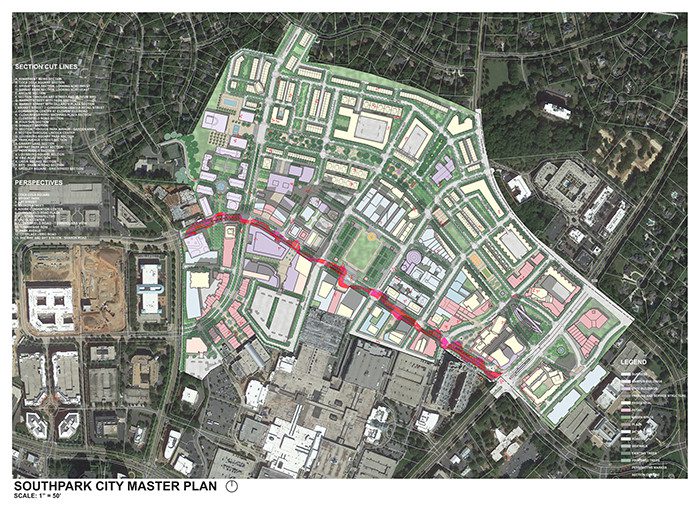
The result—offered to a group of outsider experts in December—was a plan for a collection of five overlapping “neighborhoods” in the area to the immediate north of the mall, up to Colony Road, and roughly between Barclay Downs and Sharon roads.
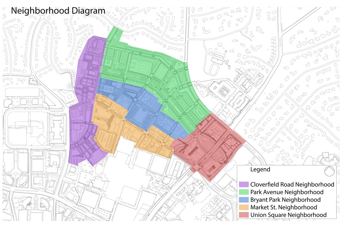
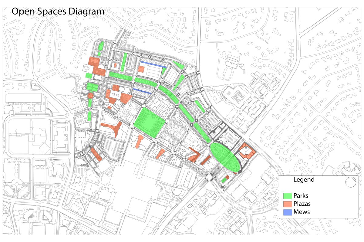
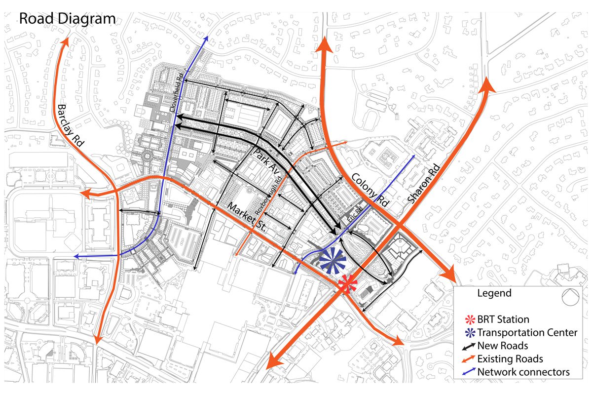
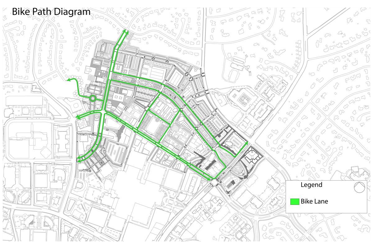
Modeling their vision on a series of successful city places from Manhattan’s Bryant Park to Boston’s Louisburg Square to the Vancouver Convention Center, the students’ goals were to create a strong system of open spaces; an expanded street network centering on the needs of pedestrians, cyclists and public transit; and to create lively city-style neighborhoods through a close-knit blend of residences, stores and workplaces.
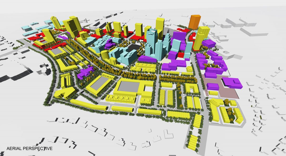
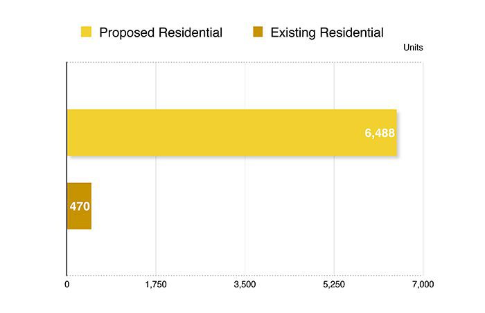
The UNCC students did not look at the whole SouthPark area and did not, for the most part, envision changes at the mall itself. In the smaller area that they covered, they tallied 470 existing residential units, and proposed a total of 6,488. They counted 5.7 acres of existing open space and proposed more than 30 acres. They found no civic spaces and proposed almost 2 million square feet. And they counted 1,573 parking spots and proposed a total of 8,261 spaces, much of it either hidden from view either underground or in parking decks surrounded with retail or residential development.
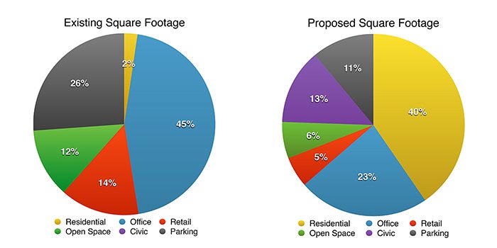
The students’ proposal was a grab bag of multiple ideas for museums, hotels, parks and mixed-use projects. Among their ideas:
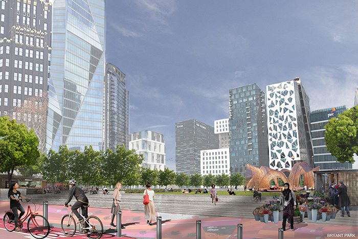
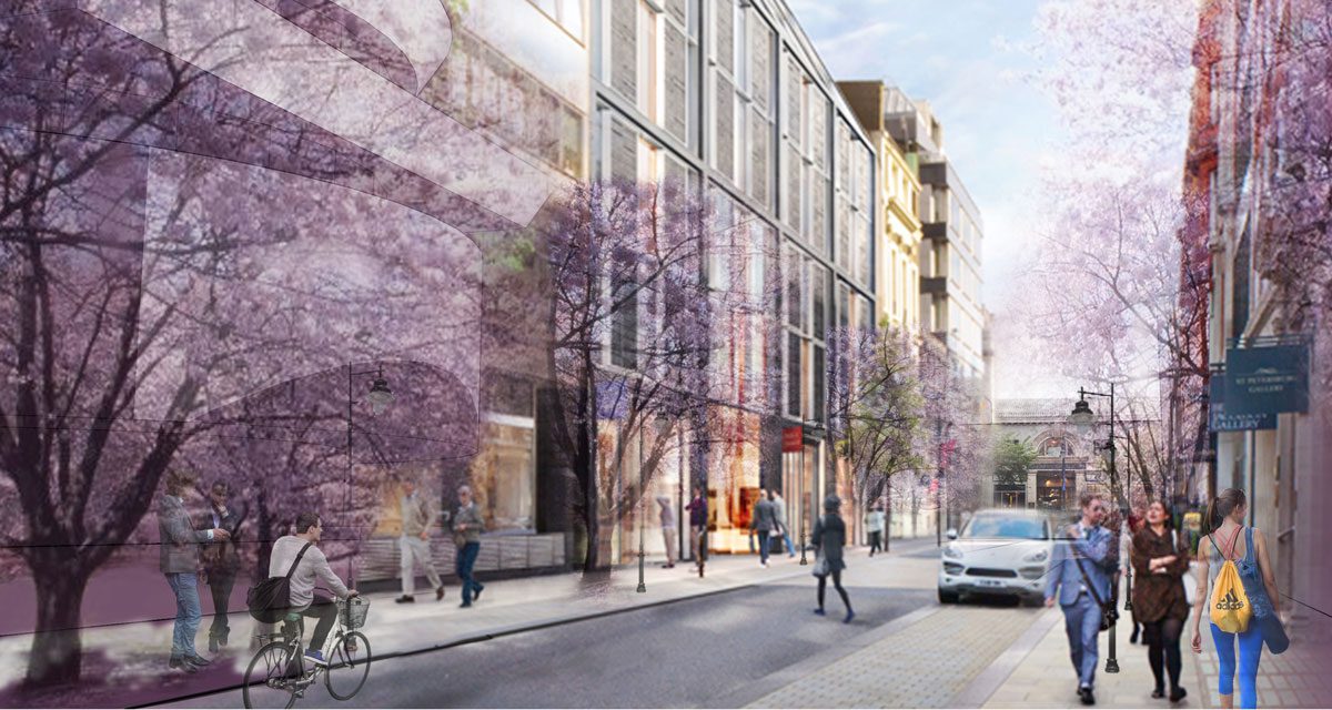
- Create a park modeled on Bryant Park in New York with year-round activities and hosting the Charlotte Symphony Orchestra Summer Pops, now at a mostly unused pavilion on a corner of the mall property. With buildings on all sides of the new park, more people would be around to use the park throughout the day, making it a livelier spot. As a twist, the students proposed a new Guggenheim Museum of Art on the park’s east side.
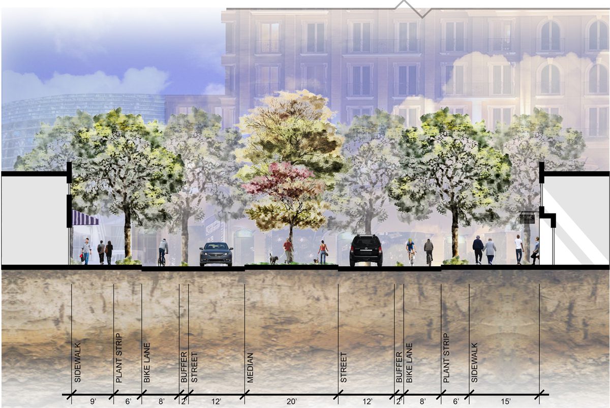
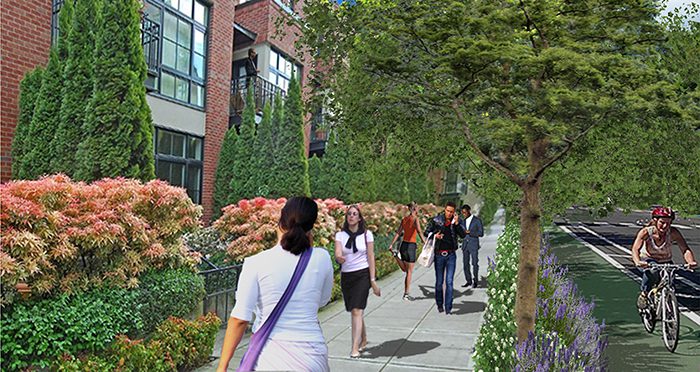
- Rexford Road, today essentially a suburban-style office park, would be transformed into a wide Park Avenue with a linear park connecting Sharon Road to the western part of the study area. The Park Avenue neighborhood would be filled with townhouses, apartments and parks, with wide, tree-lined sidewalks.
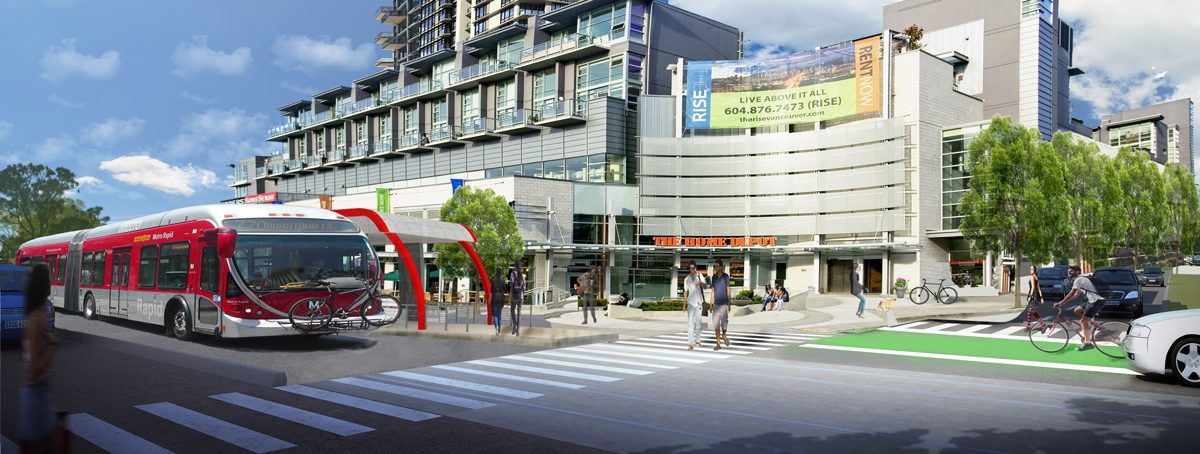
- Sitting generally where the Morrocroft Harris Teeter is today, the students envision what they dubbed the Union Square neighborhood, with a bus rapid transit station. (Bus rapid transit uses buses designed to look more like light rail cars, traveling on a separated lane to avoid traffic congestion.) They propose a development in the area called “The Rise” with a Home Depot and a grocery store.
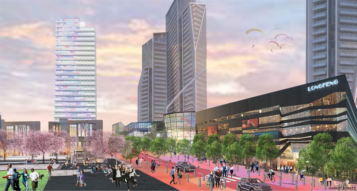
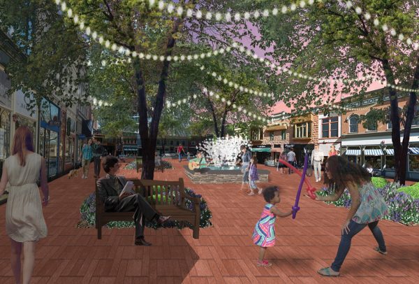
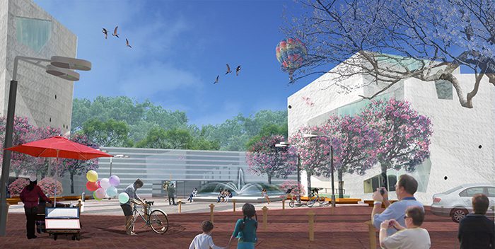
- The proposed Cloverfield neighborhood would offer a new retail plaza in front of Dick’s sporting goods store at the SouthPark mall. (See image at top of article.) The students also envision an educational campus at the northwest corner of the Cloverfield neighborhood, which would be east of Barclay Downs and Ayscough Road.
The student proposals were guided by 13 strategies, such as “Walkability and Bikability,” “Multi-Generational Design,” “Creating a Unique Sense of Place, Character, and Community,” “Economic Viability,” “Build Social Capital,” and “Preserve Natural Features.”
The ULI task
What will the ULI team study? It’s being asked to help the city come up with goals and strategies by:
- Envisioning the future of SouthPark as an evolving suburban, mixed-use activity center
- Establishing goals and expectations for future investment in the area
- Identifying tools and next steps for implementation (of the panel’s recommendations).
The city’s most recent SouthPark Small Area Plan dates to 2000. “We need to explore a more walkable, pedestrian-friendly SouthPark,” the Charlotte Observer quoted Deputy City Manager Ron Kimble as saying. Kimble also chairs the local chapter of the ULI, a nonprofit group of planners, developers and government officials.
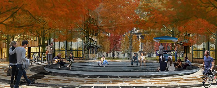
The images and ideas that follow are intended to spark readers’ imaginations. For more information about the students’ work, contact Deb Ryan, associate professor of architecture and urban design.
