DEVELOPMENT

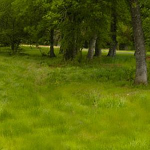
Persistently Green: Landscapes in Transition
It’s no secret that the Charlotte region has been rapidly growing more urban over the past few decades. Yet despite the record expansion of the urbanized area experienced during economic boom times, private landowners cling to over two million acres of undeveloped land in the Charlotte metropolitan region. Why do these remnants of green persist? […]
Environmental Quality of Life by the Numbers
The new Charlotte Regional Indicators Project website will go live in the next few months. This is part of a series of articles leading up to that date that will provide analysis of some of the data being tracked by the Indicators Project. How do you paint a picture of the region’s progress on environmental […]
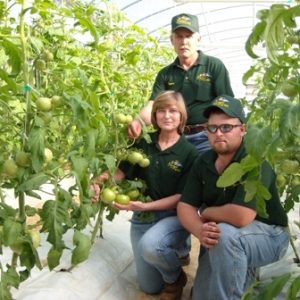
Farm Boy
Sunday night I received a photo from Tommy Barbee, showcasing his supper. “Look at what a farm boy can create,” he said. The picture displayed a bright green salad, replete with cucumbers, tomatoes, and more; all of which he had grown there at Barbee Farms. As a locavore (someone who eats a local diet), this […]

Research Triangle West: Bringing knowledge production to the western Piedmont
In the early 1950s the not yet established Research Triangle Park (RTP) was pitched to Governor Luther Hodges as a cluster of “two medical schools, two engineering schools and a core of preeminent researchers in every field of science.” Hodges response: he called the presenter (a dean at NC State College) a “huckster.”[i] North Carolinians […]

Dynamic downtowns
Twenty years ago, the downtowns in our region were believed to be destined for oblivion. Retail was leaving, if not already gone, locating along a major thoroughfare somewhere on the suburban fringe in the vicinity of the latest big box retail store, often Wal-Mart. Professional offices, if any existed at all, were shutting their doors […]
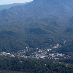
Nearly 570% Increase in Development in Western NC Mountains Since 1976
From 1976 to 2006, land development in the North Carolina mountains increased 568 percent – from 34,348 acres to 229,422 acres – and is expected to increase another 63 percent by 2030. Population, meanwhile, increased only 42 percent between 1976 and 2006 and is projected to increase only another 25 percent by 2030. The result? […]
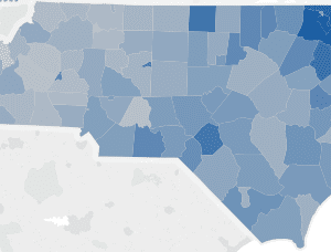
Mapping historical development patterns and forecasting urban growth in Western North Carolina
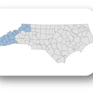
The Renaissance Computing Institute (RENCI) at UNC Charlotte expanded the urban growth mapping and forecasting into 19 counties in the Western part of North Carolina: Alleghany, Ashe, Avery, Buncombe, Cherokee, Clay, Graham, Haywood, Henderson, Jackson, Macon, Madison, Mitchell, Polk, Swain, Transylvania, Watauga, Wilkes, and Yancey Counties. The final report maps historical development patterns from 1976-2030 […]
Urban Growth Mapping & Forecasting: 1976-2030, Western NC County Profiles
The Renaissance Computing Institute (RENCI) at UNC Charlotte expanded the urban growth mapping and forecasting into 19 counties in the Western part of North Carolina: Alleghany, Ashe, Avery, Buncombe, Cherokee, Clay, Graham, Haywood, Henderson, Jackson, Macon, Madison, Mitchell, Polk, Swain, Transylvania, Watauga, Wilkes, and Yancey Counties. The full research report is available in our web […]